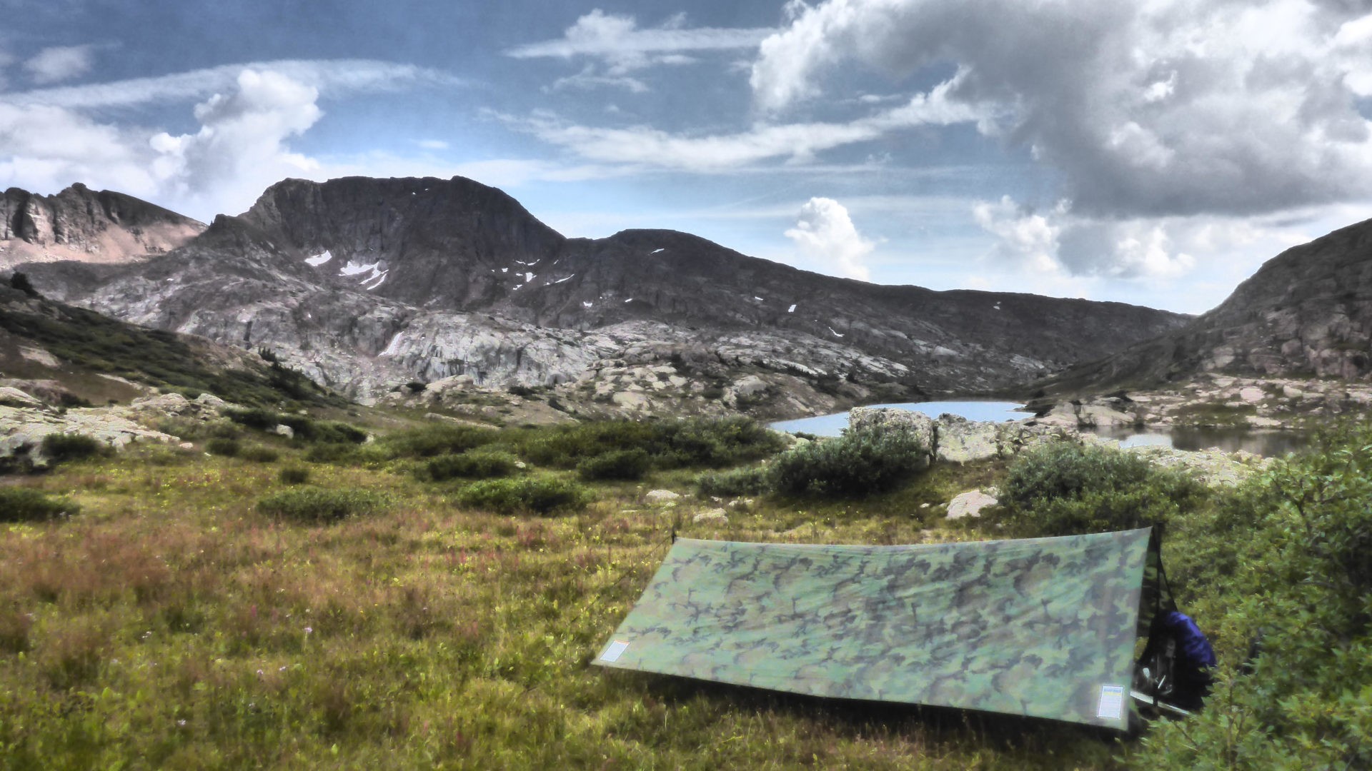
San Juan Mountains a laboratory for the study of avalanches

By Alex Miller
The San Juan Mountains Association works in partnership with our federal public lands partners to ensure that visitors to our mountains can continue to enjoy the grandiose viewsheds, beautiful hiking trails, world class off-roading, designated Wilderness Areas, and incredible winter recreation opportunities that make this area great.
Along with these claims to fame, the San Juans are also known for the huge number of avalanches they produce in the winter. Avalanches are cascading piles of snow, ice, and debris that occur on slopes steeper than thirty degrees. They require snow, which we often have here, and mountainous terrain, which we always have. Though only a winter hazard, avalanches are responsible for killing numerous backcountry travelers each year. Luckily, some wonderful resources can help visitors to southwest Colorado stay safe this winter. The Colorado Avalanche Information Center (CAIC) and the San Juan Mountains Association’s public lands stewardship programming both strive to inform winter recreationists on how to stay safe and recreate responsibly this winter.
Before the Rocky Mountains were so densely settled, mining town residents observed avalanches and developed local knowledge to avoid perishing in them. Greenhorns were filled in on how to survive their commutes to the mine, and when disaster struck, whole communities participated in rescue efforts (Di Stefano 2015). With the advent of winter recreation after World War II, local avalanche knowledge rapidly developed into a field of research with help from the US Forest Service and ski areas they managed (National Forest Foundation 2015). As the field grew, so too did the research locations, and what better place to study avalanches than the San Juan Mountains.
Several prominent avalanche researchers worked in the San Juans from the 1970s onward through the Institute of Arctic and Alpine Research’s (INSTAAR) San Juan Avalanche Project (INSTAAR History). The project’s goal was to study what caused so many avalanches here and how to mitigate the hazard they created along HWY 550. Researchers brought their avalanche experience to Silverton and, in the tradition of their mining predecessors, developed a strong, localized understanding of avalanches. This time, their local knowledge contributed to a broader community of avalanche researchers across the world and was informed by decades of scientific discussion. Between local observations and universal knowledge, INSTAAR researchers could more accurately predict when to close HWY 550 and similar mountain highways. Thus, the San Juans became not only a hub for avalanches, but a hub for their study.
After an avalanche buried and killed HWY 550 snow plow driver Eddie Imel in 1992, CDOT began sponsoring the CAIC, an organization responsible for studying and forecasting avalanche conditions throughout the state (Knox Williams 2020). The CAIC draws from the pool of knowledge established in mountains around the world, pairs it with local observations from individual mountain ranges like the San Juans, and spreads information in digestible ways to residents like you and me. For winter recreationists, checking the CAIC avalanche forecast is the first step to a fun day in the mountains. By providing this important information, the CAIC and avalanche researchers around the West are playing a vital role in helping visitors to the San Juans have safe, enjoyable trips into the mountains.
Through our winter programming and snow ambassador program, the San Juan Mountains Association is also doing its part in showing residents and visitors how to recreate responsibly in the snow. This winter, join us on one of our Full Moon Howler trips (hosted by the Durango Nordic Center), our bi-weekly Aprés Ski Science & Socials on Saturday afternoons outside the Outdoor Research tiny house north of Andrews Lake, or say “Hi” to our snow ambassador John next time you’re out for a ski tour near Molas Pass.
Alex Miller is the Montrose Public Lands Ambassador for the San Juan Mountains Association.
- Published in History, Stewardship, Winter
Wilderness with A Capital W

By MK Gunn
 What do you think of when you hear the word “wilderness”? Take a minute. Do you think of solitude or camaraderie? Of adventure or relaxation? Of wide open spaces or deep down and forested places? Do you think of wild animals – big or small? Or does the word “wilderness” conjure anything at all? And does it mean anything different with a capital W – Wilderness?
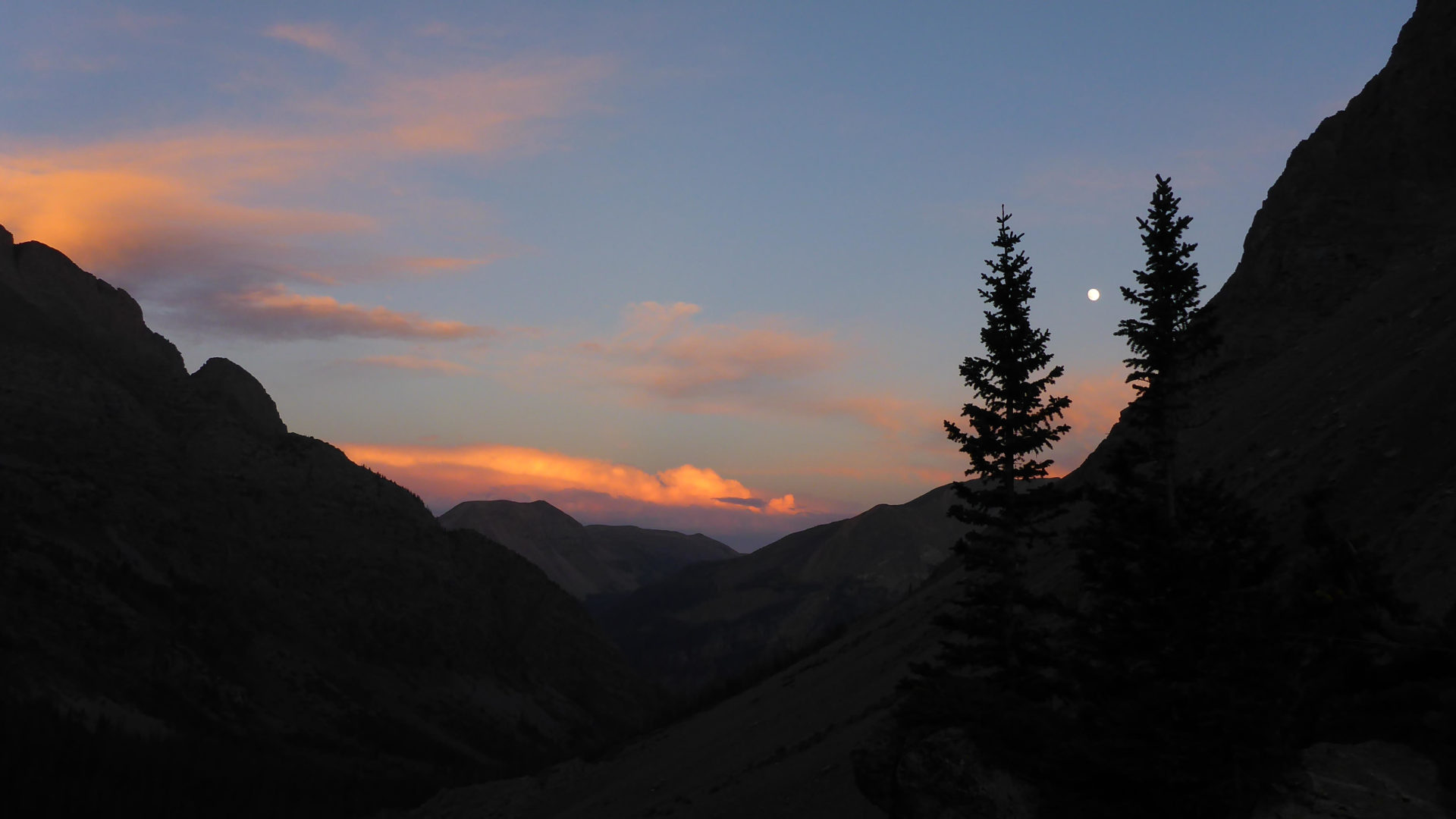
Southwest Colorado is home to the Weminuche Wilderness – the state’s largest congressionally designated Wilderness (with a capital W) area – and contains 499,771 acres of untrammeled lands. Our home turf also hosts the 158,790 acre South San Juan Wilderness, the 41,496 acre Lizard Head Wilderness, and the 37,236-acre Hermosa Creek Wilderness. That’s 737,293 acres. That’s 1,152 square miles! With all this Wilderness surrounding us, consider what you think you know about Wilderness and read on to see if you know your stuff.
The Wilderness Act was passed by the U.S. congress in 1964 thanks to the tenacity of Howard Zahniser. Sure, a myriad of others contributed to the idea, but Zahniser rewrote the bill an astounding 66 times back in the age of typewriters! He often worked on it for 30 hours straight. He also patiently attended 18 public hearings involving some 16,000 pages of testimony. All of this was to create a federal land designation never before seen in the U.S. Sadly, the stress of this killed Zahniser just months before he could see president Lyndon B. Johnson sign the act into law on September 3, 1964.
A great article on wilderness.org summarizes neatly that “Zahniser pointed out the law was intended to hold our expansionist tendencies at bay: “The nature of our civilization is such as to make wilderness preservation difficult at its best. That is the reason for wilderness legislation.” The main purpose of the Wilderness Act is to leave nature in, well, its natural state.
 So, what can you expect when you venture into a designated Wilderness area? Perhaps most obvious is the lack of motorized and mechanized equipment. Human entry can only be achieved on foot or horseback. There are no roads, motor vehicles, bicycles, or even wheel barrows. (People with disabilities are allowed to enter via wheelchair). Land managers can’t even use chainsaws to clear the trails. Wilderness rangers and partnering non-profit groups use six-foot long cross-cut saws that take two people to use. These saws are remarkably efficient and very quiet. There is some pushback on the above regulations as well as much argument over just what “mechanized” means but that is a topic for another article.
This lack of motorized equipment not only forces everyone to slow down and smell the flowers; It allows visitors to experience only the sounds of nature. Wildlife is more at ease. One time, my dogs and I were walking so quietly through the Wilderness that as we stepped out of the woods into a clearing, we inadvertently sneaked up on a young mountain lion stalking a herd of cow and calf elk! It was like being inside an episode of Plant Earth. As the Wilderness Act states, Wilderness must have “outstanding opportunities for solitude or a primitive and unconfined type of recreation”.
The Wilderness Act also mandates that there are virtually no permanent manmade structures in designated Wilderness. “A wilderness, in contrast with those areas where man and his works dominate the landscape, is hereby recognized as an area where the earth and its community of life are untrammeled by man, where man himself is a visitor who does not remain.” The word “untrammeled” is often used by Wilderness devotees. Synonyms for “trammel” include drag, hobble, curb, inhibit, impede, obstruct, and encumber. Inside a Wilderness area, you will find no fences, dams, outhouses, weather stations, corrals, or shelters with the exception of some structures that existed before the area became designated Wilderness. If some sort of structure is erected, including a tent, it must be dismantled within 14 days. However, bridges are allowed where deemed necessary for safety. Other structures may be allowed on a case by case basis so long as they are “substantially unnoticeable”. For more clarification on structures in Wilderness and much more, read US Forest Service Manual chapter 2320 entitled Wilderness Management at this link: tinyurl.com/FSM2320-WildernessManagement.
Here’s something else to keep in mind: Many designated Wilderness areas have regulations that go beyond what is stated in the Wilderness Act. For examples, campfires are not allowed in Chicago Basin and the entire Needle Creek drainage within the Weminuche Wilderness. In our four local Wilderness areas, dogs are allowed to be off leash as long as they are under voice control. However, in the Indian Peaks Wilderness west of Boulder, dogs must be on leash at all times. There are sections within other Wilderness areas where dogs are not allowed at all. Group size limits also vary. Be sure to familiarize yourself with the local regulations before visiting any swath of public lands, Wilderness or not. Often, calling the main offices and talking to a real human being is the best way to make sure you have the most up to date information. Responsible use helps keep public lands open and beautiful for future generations.

MK Gunn is Volunteer and Education Specialist for the San Juan Mountains Association. She helps manage a variety of volunteers who spend days out in the Weminuche Wilderness educating visitors. Contact her at MK@sjma.org
Ahhh, Wilderness
Early Hispano History and the Iglesia de San Antonio

By Ruth Lambert
 SJMA has begun a project to study the history of Hispano settlement along the San Juan River in Archuleta County and southeastern LaPlata County. The Hispano contributions are often unrecognized and under-appreciated yet they add a richness to our collective story.
Often at old or abandoned small settlements, the church and cemetery are the last remaining elements. In order to learn about the early settlement in the San Juan riverine area, this project studies five Catholic churches at Pagosa Junction, Trujillo, Tiffany, Allison, and the church ruins at Juanita. The project is assembling historical information from church records, genealogical data and interviews with knowledgeable people; collecting historical documents and photographs; and documenting the churches through field recording and photographs.
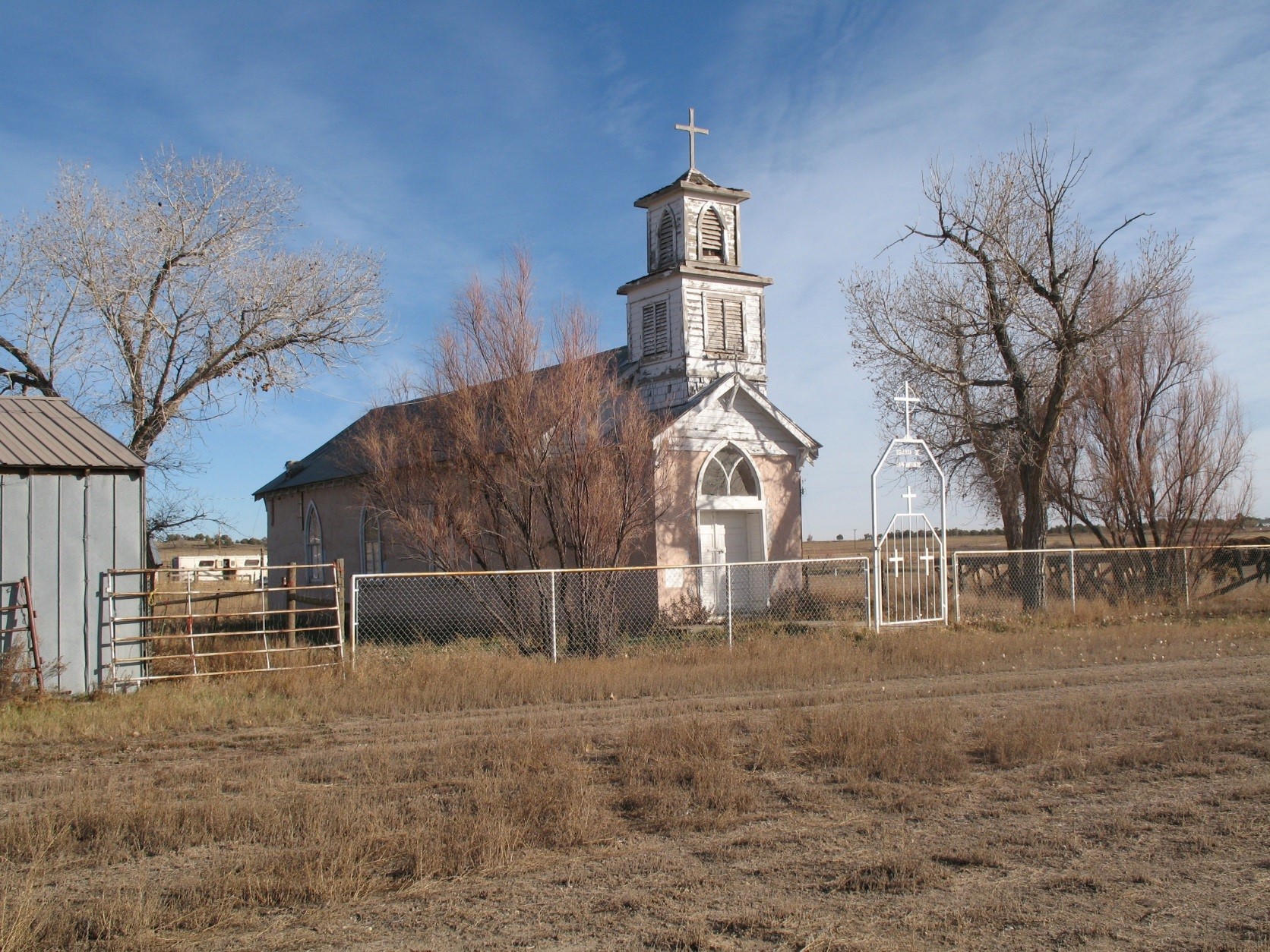
The communities of Pagosa Junction, Trujillo, and Juanita were established by Hispanos from the Tierra Amarilla and San Luis Valley areas and they developed mercantile stores, post offices, schools, mission Catholic Churches, and cemeteries. With the arrival of the Denver & Rio Grande Railroad in 1881, railroad facilities, portable saw mills, and bridges were constructed. Although some community members were employed by the railroad and lumbering industries, the settlements remained small, isolated, and Hispano with few external influences. The hamlets persisted until the 1930s through 1950s when train service was discontinued and many residents moved away. In La Plata County, the towns of Allison and Tiffany were initially established in 1881 as railroad stops that developed over time into farming communities. Hispano residents moved into these settlements for railroad work and later when lands were withdrawn from settlement along the San Juan River for a future water project that became Navajo Lake. Today, the remaining churches offer the best clues into early life along the river. The settlement of Tiffany and its church, the Iglesia de San Antonio have been the focus of recent study.
Tiffany grew from the early railroad stop in the early 1900s to establish a mercantile, expanded railroad facilities, a school, livery, and a dance hall. Ditches for irrigation and a lake were constructed to provide water for residents.
With a sizable Hispano population, the Iglesia de San Antonio, was completed in 1928 to serve local Catholic families. The building was constructed by local residents of hand-made adobe blocks that were covered by wire and stucco. The style of the church is reminiscent of Territorial Adobe buildings that were popular in San Luis Valley, and the Rosa and the Tierra Amarilla areas of New Mexico. It is all original.
The church was operated as a mission church from Sacred Heart Catholic Church in Durango and was serviced by a visiting pastor. The church operated until 1972 when the regular weekly services for the parishioners were transferred to St. Ignatius in Ignacio. Over the church’s 91 years, it has been faithfully and lovingly cared for by local families. Mass is held annually on St. Anthony’s feast day in June when church members attend the Spanish Mass.
In early 2019, the Iglesia was listed on Colorado’s Most Endangered Places List, only the second listing in La Plata County and the first listing to recognize the County’s Hispano heritage. In September, the Iglesia was listed on La Plata County Register of Historic Places.
The church is an important part of the Hispano history of our area and a priority for preservation. The next steps for church preservation are applications for grant funding for stabilization and repairs and community fund raising. Once funds are acquired work is scheduled to begin next year.
If you have historical information to share about these churches or for additional about the Tiffany Church or this project, please contact Ruth Lambert at ruth@sjma.org.
Victory Gardens
Victory Gardens
April 2017 marked the 100th anniversary of the United States entry into World War I. With the war, our country sent many young men to join European forces to fight in various war theaters. At home, Americans supported the war effort through numerous conservation efforts. One of the sayings at that time was “Conservation is Patriotic”. Even though the War effort focused attention on conservation, resource conservation, as an attempt to achieve sustainability, has at least a thousand-year history in Southwest Colorado.
Anthropologists and historians have studied human exploitation and adaptation to our fragile environments to understand prehistoric and historic occupations in our area. Numerous studies have described prehistoric human activities to cope with uncertain environmental conditions, including strategies to manage water, soil, and domesticated and wild plant foods. Research indicates that early inhabitants struggled to meet their food needs using a variety of conservation practices. Ethnographic data indicates that in many places traditional conservation techniques are still practiced and that these traditions remain an important part of the communities.
Historic records provide interesting documentation about efforts to conserve food resources. As the United States entered World War I, President Woodrow Wilson established the US Food Administration that called upon Americans to plant gardens and grow their own produce, so that government supplies could be used for the war effort. Slogans such as: “Eat potatoes, save the wheat; drive the Kaiser to defeat” were heard. In response, existing family gardens were expanded, vacant lots and parks were planted and became known as “Victory Gardens” and Americans produced about 75% of their household food needs. In 1918, the La Plata County Women’s Council established a community kitchen to train young women to can fruits and vegetables, Fort Lewis Junior College students harvested crops, and Durango planted Victory Gardens and participated in meatless and wheatless days. During World War II, family gardens again provided household produce when food rationing was implemented.
Today, household and community gardens abound to provide healthy produce for our consumption. Farmers’ markets, edible gardens and old and new orchards provide area residents with food sources that have their beginnings with indigenous and pioneer settlement, western sustainability and, more recently, the conservation efforts stimulated by World War I.
Ruth E. Lambert is the cultural program director at SJMA. Reach her at 970-385-1267 or ruth@sjma.org.
